Category Archives: Northwest Coast

ASBC Victoria: September Public Lecture – Isabelle Maurice-Hammond on Coast Salish Root Gardens

Screen Shot 2019-09-15 at 10.18.22 PM

The Archaeological Society of BC is happy to invite everyone to their first public talk of the 2019-2020 season, featuring Isabelle Maurice-Hammon, a Ph.D. candidate in Environmental Studies at UVIC, where she studies under friend of this blog, Dr. Darcy Mathews.  The text below and poster (PDF) are fairly self explanatory, suffice to say that Darcy is leading a multi-year project on ethnoecology on Tl’chés, a small island off Oak Bay/Victoria – this research is so multi-dimensional it makes my head spin, but it includes work in the intertidal zone, so it is ok by me.

Continue reading

Coast Salish “Woolly Dogs,” ca. 1946

Side view of a 14 year old dog which was shorn each year for its hair. Source: Ian McTaggart-Cowan fonds, UVIC.

Side view of a 14 year old dog which was shorn each year for its hair. Source: Ian McTaggart-Cowan fonds, UVIC.

The Coast Salish “wool dog” is an interesting example of selective breeding of dogs for a useful trait, in this case, their long, fair hair which could be cut or plucked for weaving. Susan Crockford, in her comprehensive account of Wool Dogs (downloadable!) quotes Captain Vancouver:

The dogs belonging to this tribe of Indians were numerous, and much resembled those of Pomerania, though in general somewhat larger. They were all shorn as close to the skin as sheep are in England; and so compact were their fleeces, that large portions could be lifted up by a corner without causing any separation”

While Crockford writes that the wool dog was extinct as a separate breed by 1858 (it’s raison d’etre replaced by Hudson Bay blankets), it is still interesting to see a couple of pictures dating to ca. World War 2 showing two dogs on the Saanich Peninsula with strong echoes of the Spitz-genre wool dog phenotype – indeed, caption above explicitly notes this dog was “shorn each year.”  (See also this poster (PDF) summarizing some wool dog research)

Continue reading

Environmental Archaeology of the Early B.C. Coast: A Video

Louie Wilson commanding the shovel bums on Quadra Island. Source: qmackie

Louie Wilson commanding the shovel bums on Quadra Island. Source: qmackie

There’s a cool new video just released about research in the Discovery Islands, mainly Quadra Island, on the central east coast of Vancouver Island (map). The video was produced through the Hakai Institute, a philanthropic organization which over the past decade or so has been funding a lot of primary research in ecology, geology, culture and archaeology on the B.C. Coast.  The archaeological project in the video was focused on the terminal Pleistocene and earliest Holocene, with an effort to document long-term sea level history for Quadra Island, and then use LiDAR-derived base maps to help with predictive modelling and other tools to find old sites on old coastal landforms. That was the plan! I mean, of course the real plan was that grad students would do as much of the brainwork as possible, Daryl would dig, and high-quality coffee would be made.

Continue reading

Haida Gwaii, 1787

Dixon's 1787 map showing Haida Gwaii as an Island

Dixon’s 1787 map showing Haida Gwaii as an Island. Source: Library of Congress

Old Maps are Cool.  Enough said.  Or maybe not quite enough. Continue reading

SFU Archaeology Press Back Catalogue is Online

Downloadable Selections from the Online Catalogue of SFU Archaeology Press.

Downloadable Selections from the Online Catalogue of SFU Archaeology Press.

If you’ve been to virtually any archaeology conference in the Northwest in the past I dunno, 5 decades – then you know you can reliably find Roy and Maureen Carlson at the SFU Archaeology Press book table, and if you’re like me you’ve walked away with yet another copy of Papers on Central Coast Archaeology for yet another five bucks. Yes, they are that persuasive. Since some of the back catalogue was going out of print, it is great to see that for the last couple of years the entire publication run of SFU Archaeology Press has been freely available online. This includes publications ranging from the early 1970s to 2015.

Most local archaeologists are probably aware of this but it seems worthwhile to spread the word. Continue reading

Jarring Finds

Tom Beasley with olive jar from seafloor near Langara Island. Source: Northword Magazine.

Tom Beasley with Spanish olive jar from seafloor near Langara Island. Source: Northword Magazine.

One great thing about not keeping up with a blog is so much stuff accumulates like lint in the internavel that it is easy pickings to get material to post . . . . for example, the not very well known discovery by a fisherman of a Spanish colonial olive jar fragment in the waters off northern Haida Gwaii.  There is a nice summary by Jane Stevenson of the find in a 2012 issue of Northword Magazine, and much more information in an open access 1992 article in BC Studies.

The latter article by Hector Williams et al. has some interesting tit-bits, such as that the jar has a nippled bottom. But I digress….. Continue reading

The BC Archaeology Survey

Republic of Archaeology, B.C. Archaeology Survey, 2016.

Republic of Archaeology: B.C. Archaeology Survey, 2016.

There’s a survey being taken of BC Archaeologists, First Nation, and other interest groups such as museum professionals, realtors, developers, and interested members of the public.  it’s a fairly detailed survey with some quite specific questions about the regulatory and legal process of Archaeology and “Cultural Resource Management” in BC. The survey is run by Joanne Hammond, M.A., an archaeologist based in Kamloops, who also runs the Republic of Archaeology website, which is worth a look in its own right.  The survey is only open for another 10 days or so,until December 31st.

I took the survey a few weeks ago and I expect if there is sufficient participation then the results will be quite revealing about the present and future of the practice of Archaeology in B.C.  If you’ve read this blog much (not that it is getting updated, but still) you’ll know that the context of Archaeology in BC often becomes quite political, and charged with structural as well as unintended conflicts of interest, or the appearance thereof. Working in the colonial landscape we know that those “who control the past” assume upon themselves a lot of power and influence. Is the way that archaeology happens in this Province – almost always in a relationship to development – the best it could be?  Take the survey to add your voice.

ASBC Victoria Talk: Dr. Duncan McLaren on Late Pleistocene Intertidal Archaeology on the Central Coast of BC

calvert-footprints

Footprint (left) enhanced in purple right from the intertidal zone excavations at Calvert Island. Photo and enhancement: Joanne McSporran

This months Archaeological Society of BC monthly lecture in Victoria should be excellent.  Sorry for the short notice but it is tomorrow, Tuesday 18th, at 7.30, at UVIC.  Details below or on this PDF.  It is free and open to the public.

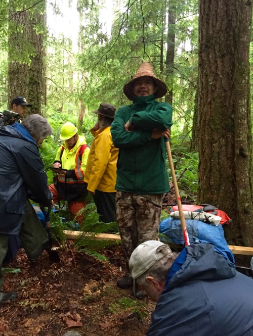
Hakai Institute Scholar and UVIC Anthropology Assistant Professor Dr. Duncan McLaren will be outlining some of the incredible finds from his Hakai Ancient Landscapes Archaeological Project (HALAP). Duncan set out to find early period sites on an area of the coast with relatively little long-term sea level change, following on from his highly successful UVIC dissertation research in the Dundas Group.  The area chosen for the new project was the Hakai Pass / Northern Calvert Island area, not far from the well-known archaeological site of Namu. Duncan will present some of his results, including newly investigated sites with more than 11,000 years of continuous occupation, intriguing lithic and other finds from the intertidal zone, and most intriguingly perhaps, a series of footprints from the intertidal zone which may well be terminal Pleistocene in age – perhaps more than 13,000 years old.

The research was carried out under the generous funding of the Hakai Institute and their Calvert Island research station, and with the active participation of the Heiltsuk and Wuikinuxv First Nations.

Details: Tuesday, Oct 18th , 7:30, Cornett B129, UVic Campus, Victoria. Map.

Duncan takes notes while Daryl Fedje works in the intertidal zone at the footprints site. Photo credit: Joanne McSporran

Duncan takes notes while Daryl Fedje works in the intertidal zone at the footprints site. Photo credit: Joanne McSporran

These Outer Shores: A special edition of BC Studies

Screen Shot 2015-11-08 at 7.47.48 PM
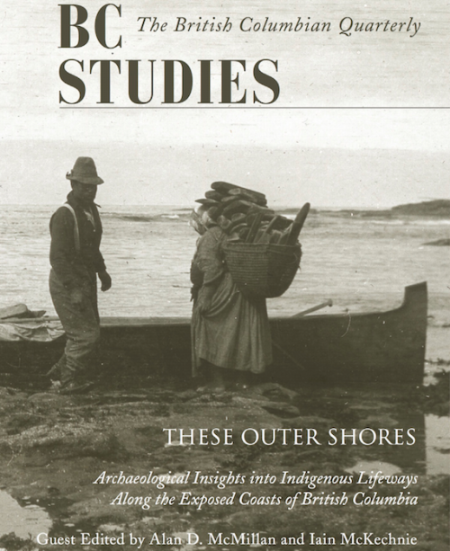
The regional journal BC Studies has a new special issue out focused on local archaeology. Entitled These Outer Shores, the edition is available for a reasonable price (20$) and two of the articles plus the forward are already open access, with the rest to follow in a couple of years.  The publisher’s blurb gives a good sense of the edition:

Guest Edited by Alan D. McMillan and Iain McKechnie, These Outer Shores presents recent archaeological research along the outer coast, from southeast Alaska to the entrance to Juan de Fuca Strait. The authors challenge the long-held perception of the western edge of British Columbia as “peripheral” or “remote,” removed from major cultural developments emanating from more interior locations. Instead, recent fieldwork and analyses document a lengthy and persistent occupation of the outer shores over the past 13,000 years. Using a variety of modern approaches and techniques, the authors examine such topics as changing sea levels, human settlement history, fish and shellfish harvesting, whaling, and the integration of Indigenous oral history with archaeology.

Continue reading

Glaciers brought mountain to man (not really)

Dionisio Point. Main vlillage sites in central upper portion of image. Credit: Colin grier via NPR.

Dionisio Point, north end of Galiano Island. Main vlillage sites (DgRv 6) in central upper portion of image. Credit: Colin grier via NPR.

A couple of months ago you may have heard of an exciting new study on the sources of rock for making stone tools in the Salish Sea.  “Glaciers brought mountain to man“, the headlines said, affirming that archaeologists working on Galiano Island had found nodules of raw material, not yet worked into tools, from the Mt. Garibaldi area of the lower mainland.  If, like me, you have a rudimentary knowledge of Salish Sea archaeology, you probably leapt to the conclusion that the raw material would be from the Garibaldi obsidian source.  So, cool: the mountain moves to Mohammed after all.  But, despite my being fairly disapproving of both sobriety and thinking in general, sober second thought did have me wondering: is it even possible that glaciers carried raw material from Garibaldi to Gabriola?  And from the relatively small and isolated high-altitude obsidian sources to a prominent village site?  ” It was brought there by glaciers, conveniently, 12,000 years ago”, the article asserts – thousands of years past the local ice maximum.  It didn’t easily compute. Luckily I was emailing with one of the paper’s authors, Dr. Colin Grier from Washington State University, and he set me straight on how the new article came to have something of a misleading takeaway point, while shedding some light on his recent interactions with the press.

Continue reading